

Key Takeaways
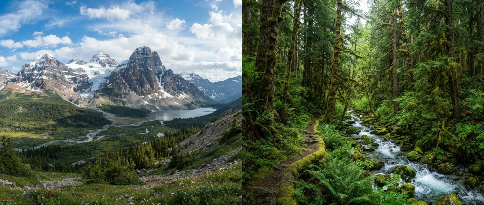
- The Mountain West is drier, sunnier, and more open, with desert plateaus, red rock formations, and high-altitude alpine terrain.
- The Pacific Northwest is wetter and heavily forested, with temperate rainforests, volcanic peaks, and dramatic coastlines.
- Season and weather tolerance are the most practical factors separating a good trip in one region from a great one.
- Both regions have world-class national parks, but the visitor experience and logistics differ considerably.
- Neither region is inherently easier or harder to travel: they reward different preferences and preparation.
Our Verdict
Both regions are genuinely wild and geographically striking, but they suit different traveler profiles. The Mountain West rewards those who want sun, open space, and high-desert scenery. The Pacific Northwest suits those drawn to forests, rain-softened landscapes, and coastal drama. The most meaningful question is not which region is better, but which one matches how you want to spend your days outdoors.
| Best for | Recommended |
|---|---|
| Travelers who want sunny, dry conditions and high-altitude desert landscapes | Mountain West |
| Travelers drawn to temperate rainforests, coastlines, and volcanic terrain | Pacific Northwest |
| First-timers looking for the most iconic and widely accessible national parks | Mountain West |
| Travelers who prefer cooler temperatures and don't mind overcast skies | Pacific Northwest |
What each region actually looks like
The Mountain West loosely covers the states running along and east of the Rockies: Colorado, Wyoming, Montana, Idaho, Utah, and Nevada. The terrain swings between extremes. Utah has slot canyons and red sandstone arches at lower elevations, while Colorado and Wyoming push into serious alpine country above 10,000 feet. Nevada's Great Basin is wide, flat, and austere. What ties them together is aridity and sky. Days are frequently clear, vegetation is sparse at the edges, and the scale of the open land is one of the region's most consistent impressions.
The Pacific Northwest (primarily Washington and Oregon, sometimes extended to include northern California) runs wetter and greener. The Cascade Range bisects both states, putting a rain shadow east of the mountains and leaving the western slopes soaked by Pacific moisture. West of the Cascades, Douglas fir forests grow thick, moss covers nearly every surface, and the coast is cold, rocky, and windswept. East of the Cascades, the landscape dries sharply into high desert and rolling wheat country. Travelers who stay west of the range get the postcard Pacific Northwest; those who cross it find something closer to the Mountain West's character.
For a broader look at how these regions compare within the national park system, see what sets each national park region apart.
Climate and when to go
Weather is where the two regions diverge most sharply for practical planning. The Mountain West generally delivers reliable summer sunshine, but altitude matters more than latitude. Afternoon thunderstorms are a daily occurrence across the Rockies from July through August, typically building by early afternoon and clearing by evening. Temperatures drop fast at elevation after dark, even in midsummer. Winter closes many high-elevation roads entirely.
The Pacific Northwest's west side is defined by a long, gray, wet season running roughly October through May. Summers in Seattle and Portland are genuinely pleasant and often dry, but that window is narrower than many visitors expect. The Olympic Peninsula, home to the Hoh Rain Forest, averages over 140 inches of precipitation per year. Travelers who arrive in March expecting spring conditions often find cold rain and limited trail access.
Time your visit for shoulder season
The shoulder seasons, late May to mid-June and September to mid-October, work well in both regions. Crowds thin, temperatures are moderate, and most high-elevation roads are passable. September is especially consistent in the Pacific Northwest, when rain holds off and summer haze clears.
The shoulder seasons, late May to mid-June and September to mid-October, work well in both regions. Crowds thin, temperatures are moderate, and most high-elevation roads are passable. September is especially consistent in the Pacific Northwest, when rain holds off and summer haze clears.
National parks and signature landscapes
The Mountain West holds an extraordinary concentration of national parks. Yellowstone and Grand Teton in Wyoming, Rocky Mountain in Colorado, Glacier in Montana, and Utah's famous five (Zion, Bryce Canyon, Arches, Canyonlands, Capitol Reef) are all within this broad region. Most are accessible by car, well-signed, and have established infrastructure for first-time visitors. The trade-off is popularity: Zion and Arches require timed entry permits during peak season, and crowding at Yellowstone's geyser basins can be significant in July and August.
| Mountain West | Pacific Northwest | |
|---|---|---|
| Typical summer weather | Sunny, dry, afternoon storms at altitude | Warm and dry west of Cascades, brief season |
| Dominant terrain | Red rock desert, alpine peaks, open basins | Rainforest, volcanic peaks, rocky coastline |
| Number of major national parks | Very high concentration | Fewer parks, each geologically distinct |
| Urban access to wilderness | Limited; mostly rural base towns | Strong; Seattle and Portland are close hubs |
| Peak season crowds | Heavy at Utah parks and Yellowstone | Moderate; Olympic and Rainier book up fast |
| Best travel season | June through September | July through September |
| Driving distances | Long; multi-day loops common | Shorter loops possible from city bases |
The Pacific Northwest has fewer marquee parks but they are geologically distinct. Olympic National Park in Washington spans three ecosystems: rainforest, alpine meadow, and coastline, all within one park boundary. Crater Lake in Oregon sits inside a collapsed volcanic caldera and holds the deepest lake in the United States. Mount Rainier dominates the skyline east of Tacoma and draws serious mountaineers. North Cascades National Park is far less visited than its peers but has some of the most rugged backcountry in the lower 48 states.
Both regions reward travelers who go beyond the most-visited sites. In the Mountain West, Great Basin National Park in Nevada sees a fraction of the traffic that Utah's parks do. In the Pacific Northwest, the Oregon Coast between Cannon Beach and Gold Beach has comparable scenery to any national park and far fewer logistical hurdles.
What the travel experience actually involves
Getting around the Mountain West almost always means driving, and distances are long. A loop through Utah's national parks covers several hundred miles even at its most compact. Fuel stops can be sparse in Nevada and Wyoming, and cell service is limited in many areas. The region's towns range from well-developed tourist hubs (Moab, Jackson, Breckenridge) to very small service communities with limited lodging options. Travelers who want urban amenities close to wilderness will find a few good bases, but not many.
The Pacific Northwest has denser infrastructure on its western side. Portland and Seattle are large, well-serviced cities with direct flights from most major US hubs, and both sit within two to three hours of significant wilderness. That proximity makes the Pacific Northwest more accessible for shorter trips. The downsides are traffic on popular routes and, in summer, reservation requirements at campgrounds in parks like Olympic and Mount Rainier.
Travelers considering the western edge of the Pacific Northwest may also want to read about the depth the Pacific Coast Highway offers beyond a weekend drive, which touches on a similar theme of slowing down to see what the region actually contains.
Travel conditions, permit requirements, road closures, and entry fees change regularly. Verify current information through the National Park Service and relevant state tourism offices before your trip.