

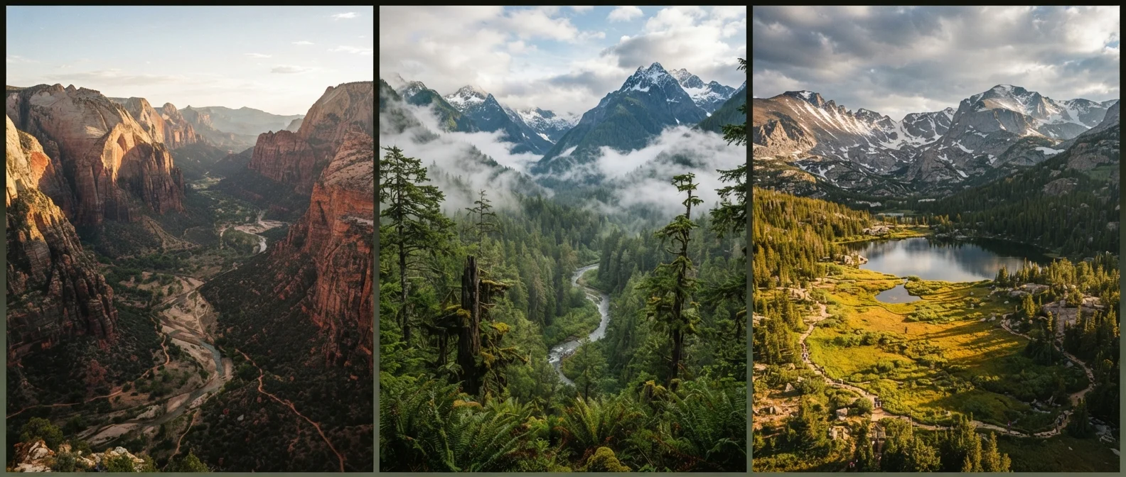
Key Takeaways
- Each U.S. national park region has its own climate, geology, and ecosystem that directly shapes the visitor experience.
- The Southwest is defined by desert heat, canyon erosion, and ancient cultural sites that require heat-specific preparation.
- The Pacific Northwest receives heavy rainfall year-round, producing dense old-growth forests and glacier-fed rivers.
- The Rocky Mountain parks combine high-altitude meadows, unpredictable weather, and wildlife corridors that demand acclimatization time.
- The Southeast contains subtropical ecosystems, including the only temperate rainforest and the largest contiguous wilderness east of the Mississippi.
- Permit requirements, crowd levels, and seasonal access vary widely between regions and individual parks.
National park regions
The U.S. National Park Service organizes its more than 400 units across geographic and ecological zones, each shaped by distinct geology, climate, and plant life. These regional groupings help explain why a park in Utah looks and feels nothing like one in Washington State. Understanding regional differences helps travelers set realistic expectations and plan for the right gear, permits, and timing.
The NPS uses administrative regions for management purposes, but geographic and ecological regions used by researchers and travel planners often differ in how they cluster parks.
Why region matters more than you might expect
Most travelers pick a national park by name recognition rather than by ecosystem. Yosemite, the Grand Canyon, and Yellowstone dominate the collective imagination, but visiting any one of them without understanding the regional context behind it can lead to real surprises: wrong gear, wrong season, wrong expectations entirely.
The physical character of each park is a product of its region's geology, weather patterns, and biological history. Those forces are not cosmetic. They shape what trails are passable, what wildlife you might encounter, how much water you need to carry, and how early in the year snow closes a road. Treating a park visit as a generic outdoor experience ignores the variables that actually determine whether a trip goes well.
Practical park preparation looks very different depending on which region you are heading into. The checklist for a week in Acadia, Maine, and a week in Big Bend, Texas, share almost nothing in common.
The Southwest: canyon country and desert geology
No region in the United States produces landscape as visually concentrated as the Colorado Plateau, which anchors parks like the Grand Canyon, Zion, Bryce Canyon, and Arches. The terrain is the result of millions of years of sediment deposition followed by erosion from wind, water, and freeze-thaw cycles. The result is exposed rock in colors ranging from deep red to pale orange to white, layered in formations that read almost like a geological timeline.
Heat is the defining constraint. Summer temperatures at canyon floors regularly exceed 110 degrees Fahrenheit, and shade is scarce on most trails. Water sources are limited and widely spaced. Monsoon season, which runs roughly July through September, brings flash flood risk to slot canyons and narrow drainages with very little warning.
The region also contains some of the densest concentrations of ancestral Indigenous cultural sites in North America, including cliff dwellings, rock art, and ceremonial structures that predate European contact by centuries. Mesa Verde, Canyon de Chelly, and Chaco Culture National Historical Park are among the places where this history is most accessible.
For travelers considering a first trip through this landscape, a structured Southwest road trip orientation covers the logistics of moving between parks and what the driving distances actually involve.
Check seasonal access before booking
Many Southwest parks limit or close certain roads and trails seasonally. Rim drives, unpaved backcountry routes, and shuttle systems all operate on schedules that shift by year. Confirm current conditions on the official NPS site for your specific park before finalizing dates.
The Pacific Northwest: rain, old growth, and volcanic terrain
Olympic National Park in Washington sits in one of the only temperate rainforests in the contiguous United States. Annual rainfall in parts of the park's Hoh Rain Forest exceeds 140 inches. The trees, many of them Sitka spruce and western red cedar, reach widths and heights that reframe what a forest looks and feels like. Moss covers nearly every surface, and the understory is dense enough to make midday feel like dusk.
The Cascade Range adds volcanic geology to the regional mix. Mount Rainier, the highest peak in the range, is a stratovolcano with more glaciers than any other mountain in the contiguous U.S. North Cascades holds what many glaciologists consider among the most complex glacial terrain in the lower 48. Both parks are subject to rapid weather changes, and trails can be snow-covered well into July at elevation.
Crowd patterns here differ from the Southwest. Olympic and North Cascades see far fewer visitors per year than Zion or the Grand Canyon, which affects trail solitude and reservation pressure. However, ferry access and backcountry conditions in the Olympics still require advance planning.
The Rockies and the Great Plains: elevation, wildlife, and open space
Rocky Mountain National Park in Colorado sits almost entirely above 8,000 feet, with Trail Ridge Road crossing the tundra at over 12,000 feet. Altitude affects everyone differently, and symptoms of altitude sickness can appear in visitors who are otherwise fit. Acclimatization, not fitness level, determines how quickly the body adjusts.
Yellowstone and Grand Teton, both in Wyoming, occupy a different character. Yellowstone sits atop one of the world's largest active volcanic systems, and its geothermal features, including geysers, hot springs, and fumaroles, exist nowhere else in comparable concentration in North America. The surrounding Greater Yellowstone Ecosystem supports one of the largest intact temperate wildlife populations on Earth, including bison, wolves, and grizzly bears.
The Great Plains parks, including Badlands and Theodore Roosevelt in North Dakota, get far less attention but offer genuinely different terrain: eroded buttes, prairie grasslands, and fossil beds that document life from tens of millions of years ago. Crowds are minimal compared to the mountain parks, and the logistics are considerably simpler.
425+
Units in the U.S. national park system
The National Park Service manages more than 425 sites across all 50 states, covering national parks, monuments, seashores, and historic sites.
12 million+
Annual visitors to Great Smoky Mountains
Great Smoky Mountains National Park consistently draws the highest annual visitation of any NPS unit, according to NPS public use statistics.
140 inches
Annual rainfall in Olympic's Hoh Rain Forest
The Hoh Rain Forest within Olympic National Park receives some of the highest annual precipitation of any location in the contiguous United States.
84 million
Acres of land managed by the NPS
The National Park Service oversees approximately 84 million acres of land, spanning every major biome in the United States.
The Southeast: subtropical systems and eastern wilderness
Great Smoky Mountains National Park receives more visitors annually than any other unit in the system, yet large portions of its backcountry remain lightly traveled. The park straddles the North Carolina-Tennessee border and contains one of the most biologically diverse temperate forests in the world, with more tree species than all of northern Europe combined.
Further south, Everglades National Park in Florida operates as a slow-moving river of grass rather than a conventional wilderness area. The ecosystem is defined by water flow, seasonal flooding, and the interaction between sawgrass prairie, mangrove estuaries, and coastal marine environments. Wildlife is abundant, but the experience is fundamentally different from any mountain or canyon park.
The Southeast also holds the only designated wilderness area east of the Mississippi River with substantial roadless acreage, found within the Okefenokee and the interior of the Smokies. For travelers who assume the eastern parks lack the drama of western ones, this region provides a correction.
The cultural dimension of travel in this region is also distinct. The American South as a travel destination involves a layered history that intersects with the park landscapes in ways that western parks rarely do.