

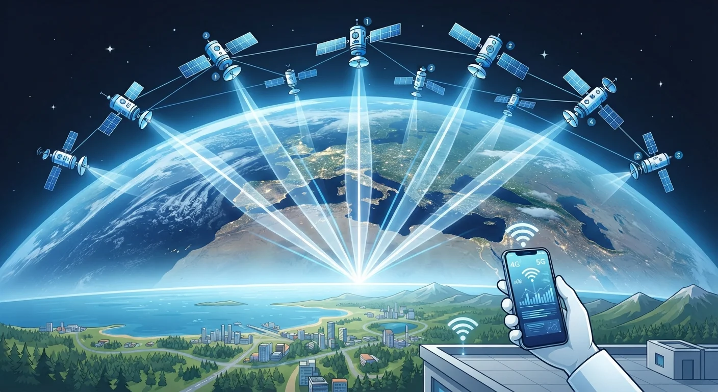
Key Takeaways
- GPS works by measuring how long radio signals take to travel from satellites to your device.
- Your receiver needs signals from at least four satellites to calculate a reliable 3D position.
- The satellites do not track you: they only broadcast; your device does all the calculating.
- Tall buildings, tunnels, and dense tree cover can block or reflect signals, reducing accuracy.
- Modern phones often combine GPS with Wi-Fi positioning and cell tower data to improve speed and accuracy indoors.
GPS (Global Positioning System)
GPS is a network of satellites orbiting Earth that continuously broadcast radio signals. A GPS receiver in your phone listens to those signals and uses the timing differences between them to calculate exactly where you are. The system works outdoors anywhere on Earth, at any time, in any weather.
The US GPS constellation consists of at least 24 operational satellites in medium Earth orbit at roughly 20,200 km altitude. Other countries operate similar systems: Russia's GLONASS, the EU's Galileo, and China's BeiDou.
Signals from space, timing on the ground
Every GPS satellite broadcasts a continuous radio signal that contains two pieces of information: the satellite's precise position in orbit and the exact time the signal was sent. Your phone's GPS chip receives that signal and compares the broadcast time with the moment of arrival. Because radio waves travel at the speed of light (about 300,000 km per second), even a tiny delay in arrival time translates to a measurable distance.
That distance calculation is called a pseudorange. One satellite gives you a distance but not a direction, so your location could be anywhere on a sphere around that satellite. A second satellite narrows things to a circle where two spheres intersect. A third satellite reduces that circle to two points, one of which is usually obviously wrong (it would place you in space or underground). A fourth satellite provides the timing correction needed to account for the small clock errors in your phone's chip, producing a precise 3D fix.
Trilateration: the geometry behind the fix
The word you often see misused for this process is "triangulation," which actually refers to angle measurements. GPS uses trilateration: it works from distances, not angles. Picture three expanding bubbles, each centered on a satellite. Where all three overlap is your position on the Earth's surface. The fourth satellite's signal resolves the altitude and corrects for clock drift.
Why four satellites and not three?
Satellite clocks are extraordinarily precise atomic clocks accurate to within nanoseconds. Your phone's internal clock is far less accurate, which is why a fourth satellite is mathematically necessary to cancel out that timing error rather than let it corrupt the position calculation. Without this correction, the position fix could be off by hundreds of kilometers.
Satellite clocks are extraordinarily precise atomic clocks accurate to within nanoseconds. Your phone's internal clock is far less accurate, which is why a fourth satellite is mathematically necessary to cancel out that timing error rather than let it corrupt the position calculation.
Why signal quality matters
GPS radio signals are faint by the time they travel 20,000 km to reach your phone. Anything that blocks or reflects them degrades accuracy. A clear view of the sky is ideal. In a dense city, signals bounce off glass towers before reaching your device, a problem called multipath error. Your reported position can shift by tens of meters as a result.
Receivers cope with multipath by ignoring signals that arrive from angles inconsistent with known satellite positions, and by averaging multiple readings over time. Smartphone chips also use a technique called assisted GPS (A-GPS), which downloads satellite orbital data over your cellular or Wi-Fi connection instead of waiting to receive it slowly from the satellites themselves. That shortcut cuts the time to first fix from up to a minute down to a few seconds.
Understanding this signal-dependency also explains why GPS is one building block in technologies like spatial computing, which layers digital content onto precise real-world coordinates. For a broader look at how location awareness connects to those emerging fields, see this plain-language explainer on spatial computing.
What your phone adds to the picture
Pure satellite GPS is just one layer in how modern smartphones determine location. When satellite signals are weak or unavailable, the phone's operating system blends in two other sources. Cell tower positioning estimates location based on which towers your phone can hear and how strong those signals are; accuracy is typically within a few hundred meters. Wi-Fi positioning compares visible network names and signal strengths against a database of known access point locations, often achieving 15 to 40 meter accuracy indoors.
The phone's motion sensors (accelerometer and gyroscope) contribute as well. If the GPS signal drops briefly in a tunnel, the phone can use sensor data to estimate how far you have traveled and in which direction, a method called dead reckoning. The combined result is a location estimate that is more stable and faster-updating than raw GPS alone.
24+
Operational GPS satellites in orbit
The US Space Force maintains a minimum of 24 active satellites to guarantee global coverage at all times.
3-5 m
Typical smartphone GPS accuracy
Under open-sky conditions, most consumer smartphones achieve a horizontal accuracy of 3 to 5 meters according to general GPS receiver specifications.
20,200 km
Altitude of GPS satellite orbits
GPS satellites orbit at medium Earth orbit, completing two full orbits per day and maintaining consistent coverage across the globe.